Old town · Explore

Frigiliana’s old town

What to see, and why it still looks like this

Frigiliana’s historic centre is not simply a photogenic village. Since 2014 it has been legally protected as a Bien de Interés Cultural in the Conjunto Histórico category, which covers the street layout, the plot structure and the buildings together rather than any single monument.

This guide is a walking companion rather than a history lecture. It follows what you actually pass on a morning through the village: the ceramic panels, the old cane-syrup works, the church square, Calle Real and the steep lanes of the Barribarto above it.

Where the popular version of the story and the documented one differ, we say so. That mostly makes the village more interesting, not less.

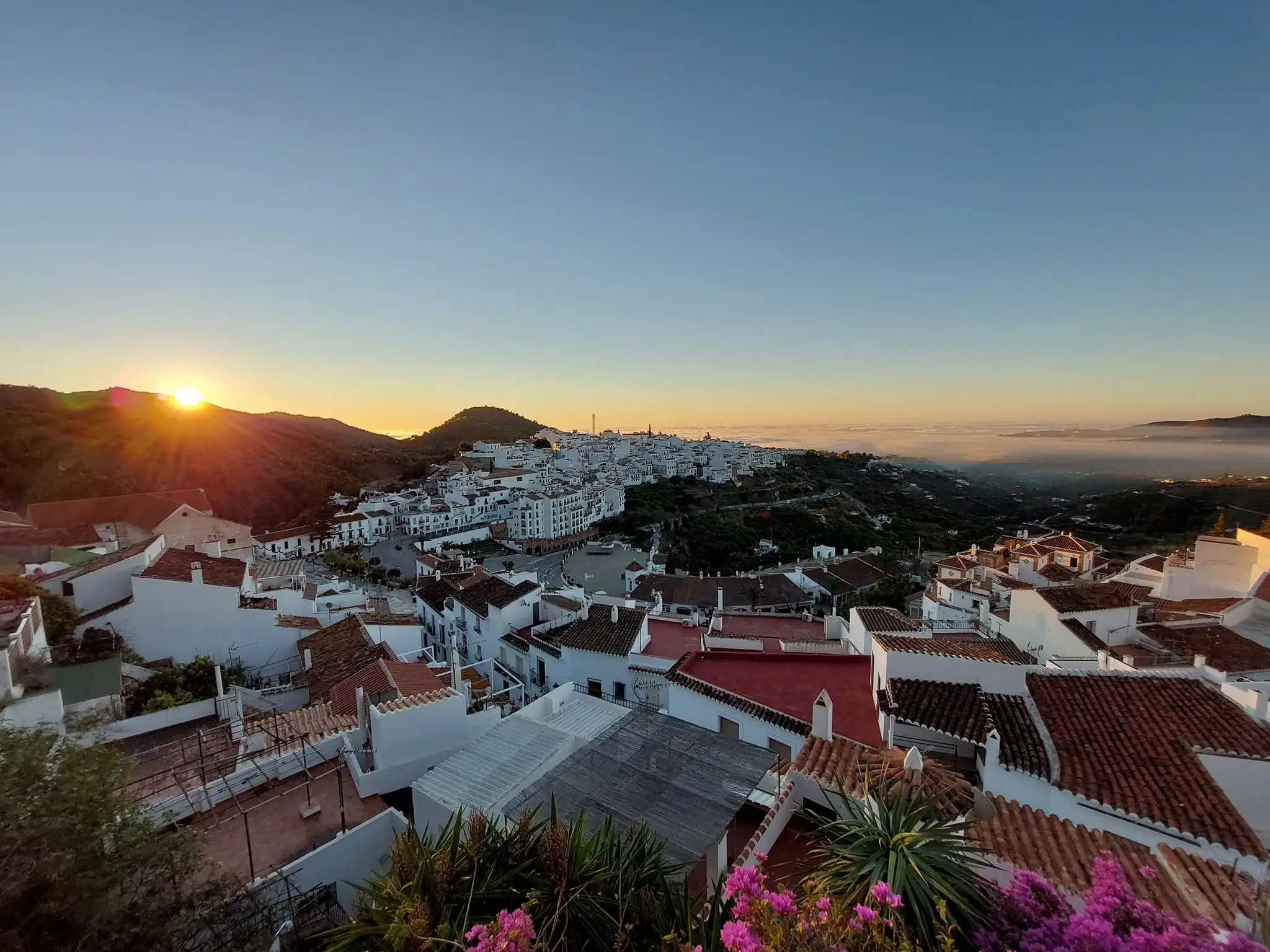
Frigiliana’s whitewashed old town at sunset, seen across the rooftops

What to look for on a walk through the centre

None of this needs a ticket or a fixed route. An unhurried hour covers most of it, and the village rewards walking the same lane twice at different times of day.

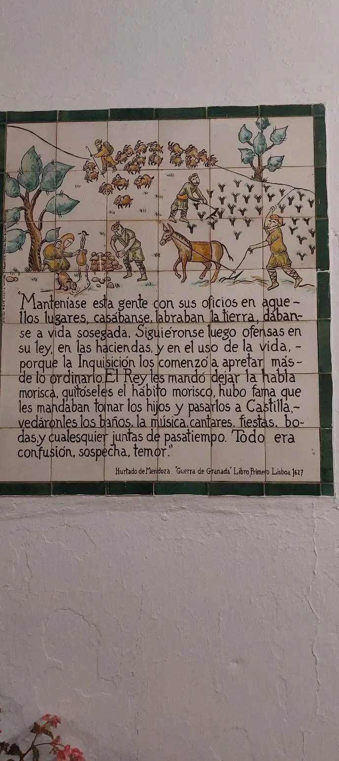
Hand-painted ceramic panel in Frigiliana’s old town showing a scene of the Morisco story

The twelve ceramic panels

A self-guided walk through 1569

Hand-painted panels set into the walls of the upper quarter tell the story of the Morisco revolt in sequence. Following all twelve is the single best way to understand what happened here, and it takes about forty-five minutes at a walking pace. The lanes are cobbled and stepped, so wear shoes with grip.

All twelve panels, with the original texts
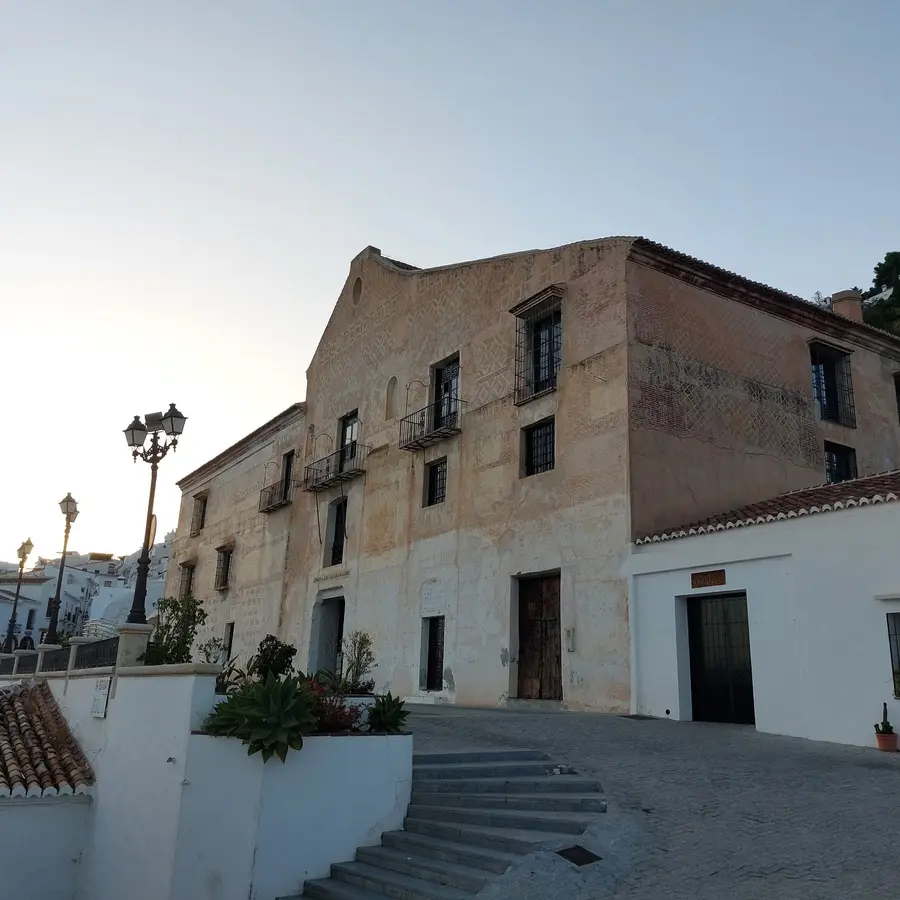
El Ingenio, the former sugar works, at the lower edge of Frigiliana’s old town

El Ingenio

A working factory, not a museum

The large building at the lower end of the village is often described as a count’s palace. Archive research published in 2023 places it more precisely: it was built around 1725 as an industrial sugar works and was fully operating by 1728. Today it houses the Nuestra Señora del Carmen factory, where miel de caña is still made — a concentrated cane syrup with a long local production tradition. It is a production site, so do not count on going in.

El Ingenio: palace, sugar works and the ibex on the roof

Casa del Apero

Farm store turned cultural centre

Built in the early 17th century as El Ingenio’s farm annex — granary, stables and store for the apero, the farming gear — the Casa del Apero today holds the village cultural centre: the municipal library, the Frigiliana archaeological museum, the historical archive and the tourist office. It is the most practical stop on the walk: current opening times, festival programmes or a village map are here.

Casa del Apero: the farm store that became the cultural centre
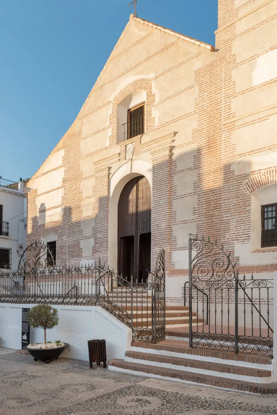
The Baroque façade of the Iglesia de San Antonio de Padua in Frigiliana, with the bishop’s coat of arms above the door

Iglesia de San Antonio de Padua

Plain Baroque, late 17th century

The present church was completed in 1676 under the direction of Bernardo de Godoy and altered about a century later. Its whitewashed brick pilasters, lantern dome and timber roof structure make it a simple landmark beside Calle Real.

San Antonio de Padua: the 1676 parish church
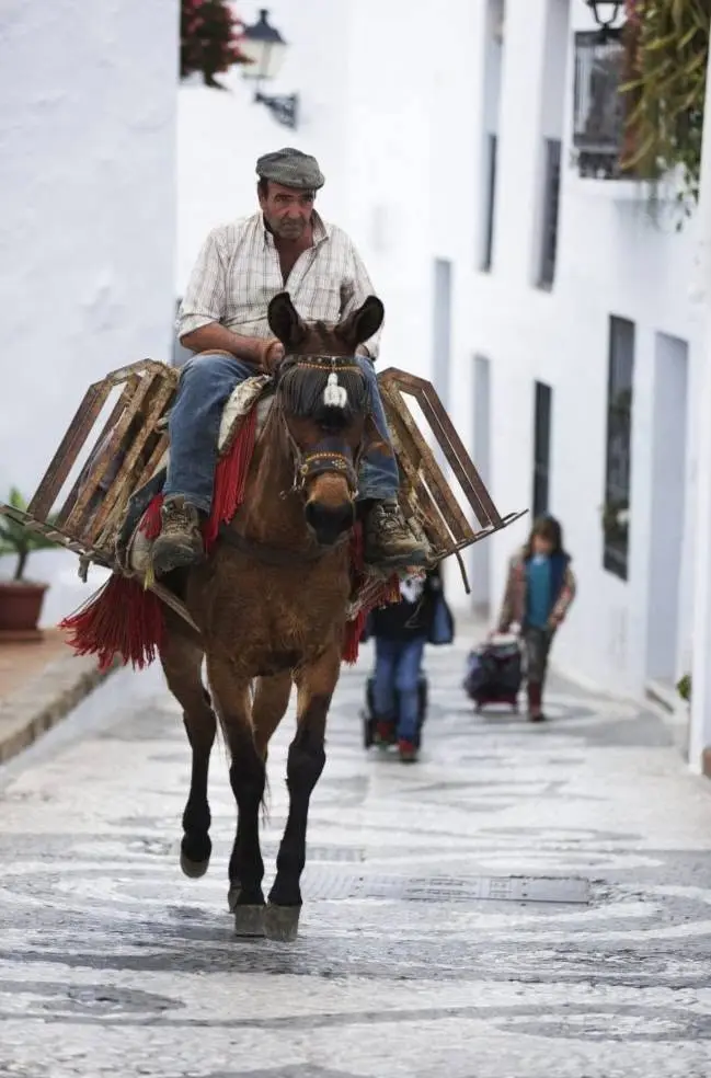
A man on a mule in a lane of Frigiliana’s old town

Calle Real and the Barribajo

The wide, wealthier axis

The lower part of the historic centre grew along Calle Real, the main axis. Plots are larger here, houses are mostly three storeys, and the architectural detail is more formal than higher up. The Torreón on Calle Real is one of the landmarks named in the heritage decree. This is also the flattest walking in the old town.

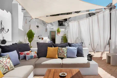
Calle Real & the Barribajo: the wide lower axis — and Casa AMARA
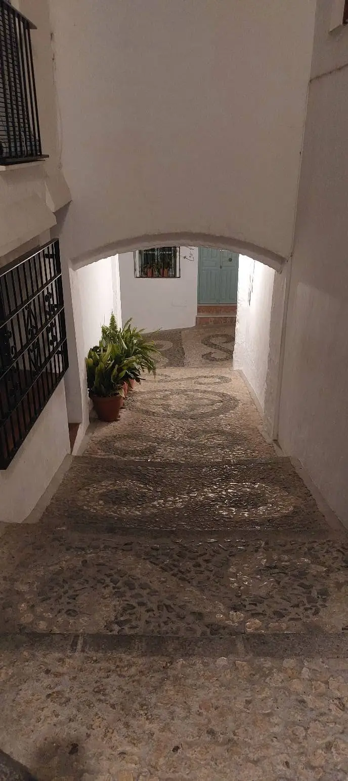
Stepped lane with an arch and pebble mosaic in the upper old town of Frigiliana at dusk

Barribarto

The medieval upper quarter

Above Calle Real the grain changes completely: tiny plots, mostly two storeys, houses built into and around the rock. Some passages are adarves, half-private lanes that serve only the houses on them — worth remembering before wandering into one. This is the most photographed part of the village and the most demanding to walk.

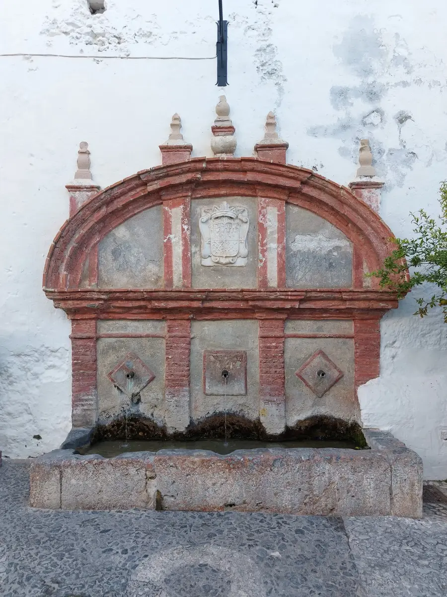
The Fuente Vieja in Frigiliana, a brick arch fountain with the weathered counts’ coat of arms and three spouts

Fuente Vieja

The old fountain of 1640

Built around 1640 by Don Íñigo Manrique de Lara, fifth Señor and first Count of Frigiliana, the Fuente Vieja was first called the “Fuente Nueva”. Its two-storey stone front carries the counts’ coat of arms in the upper central field, and three spouts still run into the trough that once watered the village animals too.

Fuente Vieja: the old fountain of 1640

Restos del Castillo de Lizar

Ruined Moorish fortress, 9th–11th c.

The wall remains of a Moorish fortress above the village, reckoned to the ninth to eleventh centuries. The crown had it largely razed after the 1569 uprising so it could not shelter rebels again; only limited masonry survives. Come for the vantage and the way it explains the medieval defensive line.

Castillo de Lizar: the ruined Moorish fortress

Los Reales Pósitos

The 1767 grain store

A public grain bank of 1767, built to secure the villagers’ supply through bad harvests. The structure is now folded into private houses, but its well-kept red-brick arches stand clear of the surrounding whitewash — a key witness to the village’s economic history.

Los Reales Pósitos: the 1767 grain store

Ermita de Ecce Homo

Chapel of the Santo Cristo de la Caña, 18th c.

A small single-nave chapel of the eighteenth century at the edge of the old town, home to the Santo Cristo de la Caña — the reed of the mocked Christ, not the sugar cane. Once a year, on Holy Wednesday (Miércoles Santo), its image is carried in procession to the church of San Antonio.

Ermita de Ecce Homo: the chapel of the Santo Cristo de la Caña

Callejón del Peñón & miradores

The photographed lane, and the miradores

The steep, much-photographed lane in the upper quarter opens at the top over the tiled roofs to the valley, the sierra and, on a clear day, the sea — the same heights above the village where the 1569 stand was made. Named miradores nearby, at Santo Cristo and the Plaza de las Tres Culturas, catch the same view; the light is best early and late.

Callejón del Peñón & miradores: the view of El Fuerte

What happened here in 1569

The ceramic panels tell this story in pictures. Here it is in four steps, with the dates that guidebooks most often get wrong.

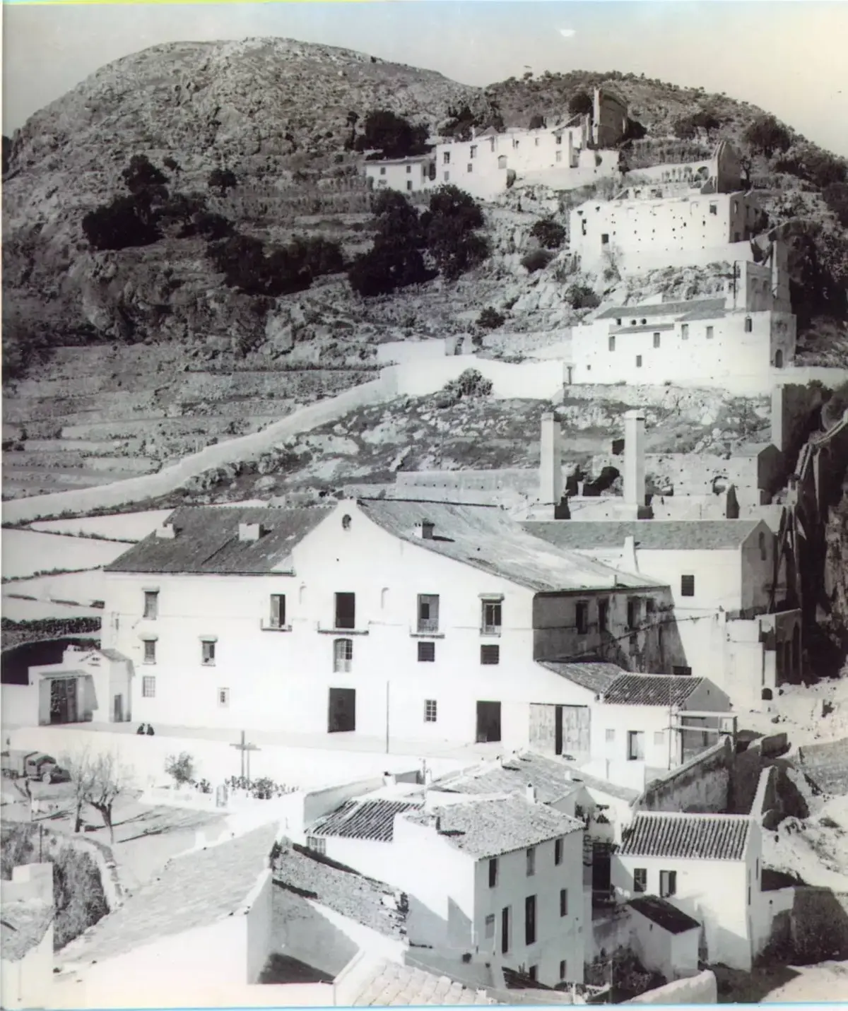
Historic photograph of Frigiliana below the Peñón, with the old sugar-works chimneys

Before the village

Finds, but no founding

The municipality holds real archaeology — a late-Neolithic cave, a Bronze Age settlement site, and an Iron Age cremation necropolis at Cerrillo de las Sombras showing Phoenician contact in the 7th and 6th centuries BC. None of it amounts to a Phoenician founding of the village. The settlement you walk through takes its shape much later, in the Andalusi-Nasrid period.

1487 to 1567

Conquest, then rising pressure

Castile took the region in May 1487, and a large Muslim population stayed on. A royal tax record of 1497 lists 742 taxable men of military age here, pointing to a community of well over two thousand people. Forced conversions around 1500 and an increasingly restrictive cultural policy — culminating in the royal decree of 1567 — built the pressure that broke in 1569.

Two battles, not one

28 May failed · 11 June decided it

Rebel communities withdrew to the Peñón de Frigiliana — El Fuerte — with their families and livestock, under Hernando el Darra, whose ancestors had held office in the village. Guidebooks usually date the battle to 28 May 1569. That was the first royal assault, and it failed: the defenders drove it off with slings and thrown stones. The crown then brought in far larger forces, and the decisive attack came on 11 June 1569.

After 1570

An emptied village, then a new one

The remaining Morisco population was deported from the Kingdom of Granada in 1570, and the village was left demographically empty. Frigiliana had been a private lordship since 1508, so resettlement was organised directly by the lords rather than through the usual crown redistribution. Sugar cane planting followed, and the village became a self-governing villa in 1640.

Why it still looks like this

The village does not stay white by habit. Building work in the protected area follows conservation rules, and knowing them changes how the streets read.

White is a requirement

Keeping the white façade finish is part of the conservation conditions for the protected centre. The colour is not a marketing decision taken at some point in the past; it is the condition under which the ensemble is maintained.

The blue doors are not a rule

A common line is that the white houses must have blue doors. They must not. What the conservation conditions ask for is that historic woodwork and window grilles keep their original design, material and dimensions — which is why the doors you photograph are so varied rather than uniformly blue.

Roofs and rooflines

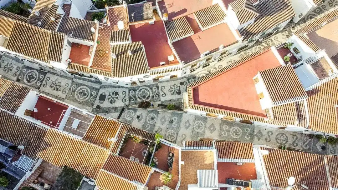
When a roof is replaced, curved ceramic tiles are required. It is a small rule with a large effect: it is the reason the view down over the village reads as one continuous surface rather than a patchwork of materials.

Aerial view of Frigiliana’s tiled roofs and a pebble-mosaic lane

Still made here

Two things in the village are not heritage in the display-case sense. They are worked on, sold and eaten.

Esparto weaving

Esparto grass weaving has largely disappeared from the Axarquía with agricultural mechanisation, but it is still practised here as a working craft. The weaver Lourdes Bueno gathers the grass herself in the Sierra de Almijara, washes and dries it, and makes bags, baskets, lamps and decorative pieces at her workshop El Rincón del Esparto. She also gives demonstrations and introductory sessions, including during the Three Cultures festival.

Miel de caña

The village syrup is a concentrated cane juice, not molasses — molasses is what is left after sugar crystallises out, while miel de caña keeps the whole unrefined juice. Try it on toast or fresh cheese, or in the classic fried aubergines. At the Cruces de Mayo, neighbours still cook arropía with it.

Where the old town leads next

The centre is at its best when something else is happening in it — a market morning, a festival evening, or simply a table booked at the right hour.

Festivals & traditions

The same lanes carry the Holy Week processions, the May crosses and the largest cultural weekend of the year. Each changes how the centre can be used.

See the festival year

Thursday market

The weekly market sits in the lower village, a short and mostly level walk from the old-town streets. It is the easiest way to combine the centre with an ordinary local morning.

Plan a market morning

Restaurants & local food

Most of the village tables sit inside or just below the protected centre, which is why an evening here usually ends within a few minutes’ walk of where it started.

Find a table

Your direct-booking advantage

What we recommend to friends is in the Guest Guide.

Book directly with us and the AMARA Guest Guide for Frigiliana comes with your stay: the addresses we give our friends, and the details that make the day easier.

  • Our addresses in Frigiliana: restaurants, beaches, walks, some of them only there
  • The way from your front door, in minutes

Links to look into it yourself

Dates, building classifications and conservation conditions follow the Andalusian heritage decree for the Conjunto Histórico and published archive research; the 1569 sequence follows the contemporary chronicle rather than visitor summaries. As of August 2026.

Official monument information

Stay inside the story, not next to it

Casa AMARA sits in the lower part of the historic centre, near San Antonio. From here you reach Calle Real and several everyday destinations without the long stair runs of the upper Barribarto — which makes a practical difference with shopping, luggage or several trips in a day.